Friday, 23 July 2021

'Kaapse Bossen', retracing my steps

Yesterday I went for a walk through woods which I have loved since I first set foot in them in my teens. As a family with five children and little money, it was not easy to afford a holiday when I was a child. But we were lucky to live on the coast and so easily swapped houses with families living in wooded parts of the country.  Life was simple. We cycled, went for long walks, picked blackberries or blueberries according to the season, enjoyed different views, the purple heather, the ice-cold water of the brooks which we discovered, shelled peanuts, explored the woods opposite which surrounded some of the houses we lived in during the holidays, and had chores peeling the potatoes, shelling peas and washing the dishes. 

The 'Postweg'
A field surrounded by a strip of wild flowers

When I was in my early teens, we had the luxury to stay in a guesthouse, in a former country house, at that time a conference centre and a holiday place for families. It was situated on the border of farmland and the wooded sandhills, a place for many rich farms and big country houses. Opposite, across a provincial road, were the woods, the ‘Kaapse Bossen’. As a child I had a love-hate relationship with the sea, or rather the beach. It was too hot in summer, and too windy and cold in a winter, with no trees to provide shelter against the elements, or the burning sun in summer which gave me headaches and blistered my skin, even gave me sun stroke once which made me very ill indeed. I was delighted by the woods, the trees protecting me from the sun, and giving shelter against wind and rain. Besides, those woods are not flat, but in fact on a sandy ridge which stretches from west to east through two provinces.

Some of the pretty row of cottages, once labourers' cottages for the people working in depot Sandenburg of a tramway which from 1885 till the end of World War II, when the line was bombed, connected Doorn with Wijk bij Duurstede.

I have crossed through that area many times since, by car, by bike, enjoying it, but I never again walked in those woods. So I decided to give it a go, headed in that direction and put on my walking shoes.

Corn and wild flowers

The first leg of the walk went through the area opposite the woods, where the guesthouse was, a rural area with fields, meadows where cows lazily grazed, interspersed with woodland, dissected by treelined lanes and dirt roads. To my delight the fields planted with corn were on four sides surrounded by a strip of wild flowers, so important for butterflies, bees and wildlife in general. Among them bright red poppies and blue cornflowers, the latter rarely seen nowadays. I walked along the ‘Postweg’ , which I already adored as a teenager, a dirt road now so full of potholes and deep ridges, filled with water from recent heavy rainfall, that any stage coach would surely be wrecked immediately. It was quiet with hardly anybody around. Only the wind rustling the leaves could be heard. The beech trees are very mature, their silver-grey, straight trunks proud and elegant. Many rhododendrons grow here as well, once planted on the estates, at this time of year in midsummer unfortunately no longer in bloom. Most of them so large that as youngsters we could hide in them. Then they seemed dark and menacing, taken from a fairy-tale story.

The 'Kaapse Bossen'
Crossing the road into the woods again, I really missed the fields, the lanes and the lush vegetation of that first part of the walk. But the woods too are varied, the large areas with pine trees in places dissected by drives and avenues lined with oak trees and beeches, some still leading to large houses hidden in the woods on the top of a hill. 

The woods are very diverse
A deer gazing in a field surrounding one of the big estates, the Ruiterberg
The gatehouse to the 'Ruiterberg'

The ramshackle and simple wooden view tower I remembered had been replaced by an ultra-modern and very high viewing tower with so many steps that I decided to leave that for another time. Perhaps a pity, as it seems to offer a beautiful and far reaching view over the treetops towards the river Rhine and some far-off cities with characteristic towers. 

The modern viewing tower, 'De Kaap'

On another hill is a very nice teashop and restaurant, the Helena Hill. When we were young, we thought it looked very attractive indeed, but it was far too expensive to have a drink there with our family of seven. Now of course I could and I did, enjoying the view, a delicious cake and the place itself enormously. It gave me new energy for the last part of this walk.

Helena hill, the restaurant
Daytrips are all very well, as Holland is not very big. The trouble is the intensity of the traffic. The former guesthouse on the other side of the road would have been a perfect place for an overnight stay. But even a not unusual delay because of a traffic jam on my way back, did not spoil my day. I was happy to put my feet up once at home, and enjoy a home-cooked meal and a glass of wine.


No social distancing here, but an embrace
Tree Yoga?
Rowan berries in different stages of ripeness


Monday, 19 July 2021

Swollen rivers and fortified towns

A beautiful summer day, after weeks of rain, cold winds from the North and overcast skies. A Saturday, and perfect for going out, enjoying the weather and exploring. Covid rules have been relaxed, and although the number of infected people has risen fast, we are still able to go out.

Belgium and Germany have suffered terrible losses because of floods, as peacefully meandering and gurgling brooks have been changed into wild rivers, the water destroying everything in its path, thundering through picturesque villages, causing houses to crumble like matchboxes, mudslides doing the rest and wiping out large sections of small towns.  There is not only terrible loss of possessions, houses, goods, not to mention the infrastructure, but far worse loss of many lives, people having been buried under their own houses or swept away by the floods which took everyone by surprise. Because of the unusual amount of rain in the surrounding hills, the small and narrow streams couldn’t cope with all the water. Nor the big rivers, which had to deal with all this extra water from the many tributary brooks and streams, now roaring rivers. Along those rivers, towns and cities have been evacuated and several have been flooded. Those rivers eventually empty out into the North Sea, but downstream, more to the North and West, the land is flat and many provisions have been made in the past to give water more space. Dikes have been reenforced and heightened, water meadows no longer are enclosed by dikes so that they can be used as an overflow.

Woudrichem. A view of the mooring site from one the fortfication points. Left he sturdy and high city walls
No meadows or footpath left here
The regular ferry service on this part of the river Waal
Houses along the top of the city wall. They have a splendid view of the river.
I went to see a small and attractive fortified town, Woudrichem, a place popular with tourists. It is well protected by the high and strong walls of its fortifications, the starshaped battlements still adorned with guns pointing menacingly in the direction of the now swollen river, the direction from which in historic times the enemy would come. Sometimes the river here is clear and calm, now it is a wild stream, muddied by all the debris it carries with it from the devastated areas. The water meadows are normally full of campsites in summer. But the water level went up so fast, that people had to leave their belongings behind to save themselves. Trees, camping gear and camping tables, are all swept away and carried towards the sea. Fortunately in Woudrichem campsites were moved to higher plots of land in time.

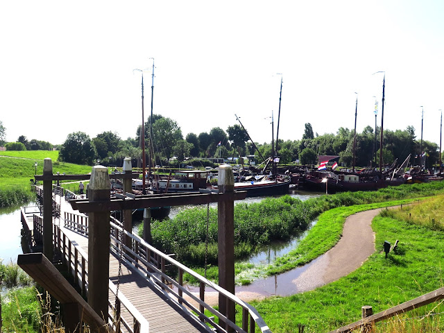
Normally the historic ships are moored here, but they had to be moved to another part of the habour as the mooring site is unaccessible

The docking place of the ferry
The empty harbour for the historic ships. The water level is too high

For the time being the historic ships are moored here.

In Woudrichem, no rubbish is visible. The water of the river is brown and muddy, the stream dangerously fast. Any pleasure boats, of which there are many during the summer season, are strictly forbidden. The current is too strong and pleasure boats might be hit by hidden rubbish. To my surprise, a ferry, an official means of public transport, is still sailing and mooring very carefully to let off cyclists and foot passengers. 

Loevestein, the castle, is just about visible across the swollen waters of an old river branch. For here is a confluence of rivers

The small foot ferry to a famous castle nearby, Loevestein, has stopped its service. The water level is too high, and the meadows with the footpath towards the castle may well be partly flooded. Mooring is impossible anyway. In spite of all the devastation, disaster and loss of life further upstream, the town looks as pleasant and cheerful as ever, the boards closing the walls if the water would reach a dangerous level, still absent, the quays half flooded by the water, cyclists enjoying themselves.

The gate leading from the river to the church at the other end of the main street, where there is another gate, not half as impressive

Gates around the church green
Unfortunately the church is closed, as always when I visit this town

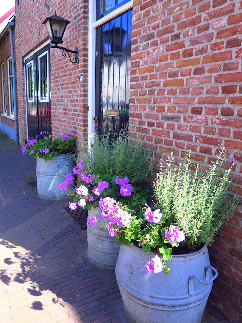
I walk around the battlements, enjoy some nice freshly fried fish nuggets form a stall on the now narrow quayside, drink something in one of the few curb side cafes. The well-kept houses have pots of flowers and flowering shrubs next to their front doors. The street names are a reminder that once this town counted several monasteries and nunneries.

 One of the 'points' of the star shaped battlements
A view from the walls of the mooring site and harbour, now almost flooded
A statue of a fisherman, specializing in cathing salmon. Apparently the river used to be much cleaner and better accessible for the salmon. They have almost completely disappeared now from our rivers.
Loevestein is just about visible on the other side of the water
Woudrichem has many interesting historic buildings and houses, as well as gablestones


After a few hours I drive on to Zaltbommel, a much bigger town, also fortified with strong walls and gates. It is situated on the same river Waal, a bit more upstream. The water meadows here are in places used as parking areas. Big yellow notice boards tell car owners that they park at their own risk as the water may quickly rise and cars may be swallowed up by the river.  I do find a spot which seems fairly safe, as long as the water level does not rise all of a sudden.

The interior of the church in Zaltbommel, the St. Maarten Kerk. I arrived rather late, and so did not go round the town to take pictures. A pity, as it is a very interesting town, and much bigger than Woudrichem. But I once wrote a blog about Zaltbommel, with photos.

This town too goes back a long way and is historically very interesting. A walk along the river front with its high and strong walls is very pleasant. The water meadows, popular with hikers, have disappeared under water. Only big river barges with cargo can navigate this now wild river.

The purpose of my visit is an organ recital in the imposing main church with its beautiful pipe organ. Many other friends of the organist have also travelled this way to attend this concert after almost 1,5 years of absence of any form of culture. Because of Covid regulations chairs are placed far apart, but there is enough space for everybody in this cathedral sized historic church. Although we have all heard most of the music before, it is a huge pleasure to be able to attend an organ recital again, especially here. 

Angels playing musical instuments. Frescoes on the ceiling

One of the many old wooden pews for the rich and famous.
Afterwards I have a drink with a few friends. To my relief my car is still parked on dry ground. The orange sky over the wide river is beautiful. I start my drive home, happy and content. It has been a glorious day.
Across the river at 22.30, windmills against the rose coloured evening sky
My parking spot, just about dry!
This iron man in the water meadow indicates the highest level of the river. Fortunately it hadn't yet reached that level, or my car would have been lost

Followers

Blog Archive